
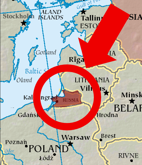
The Kaliningrad exclave is Russian land with no land connection to Russia itself. The strange split traces back to the fall of Nazi Germany.
If you zoom in on Europe, you’ll notice something that doesn’t belong — the Kaliningrad exclave, a small piece of Russia completely separated from the rest of the country… a small piece of Russia, completely separated from the rest of the country, wedged between Poland and Lithuania. It looks like a mistake. It isn’t.
But, why is Kaliningrad separate from Russia? Let’s figure out what’s going on, and why this tiny slice of Russia seems to have slipped through the cracks of history. To understand how it ended up here, you first have to go back.
Before World War II, that strip of land was actually a part of Germany, known as East Prussia. Wait, what’s “Prussia”? No, it’s not a misspelling of Russia. Prussia was a powerful German-speaking state that dominated Central Europe long before modern Germany existed.
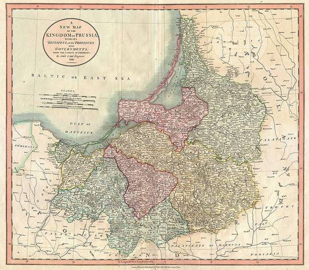
Welcome to East Prussia in 1799. No, not Russia – not yet, at least.
Prussia was instrumental in the unification of Germany. Without it, it may never have happened. When unification did happen in 1871, the Kingdom of Prussia became a part of it – and with it, East Prussia.
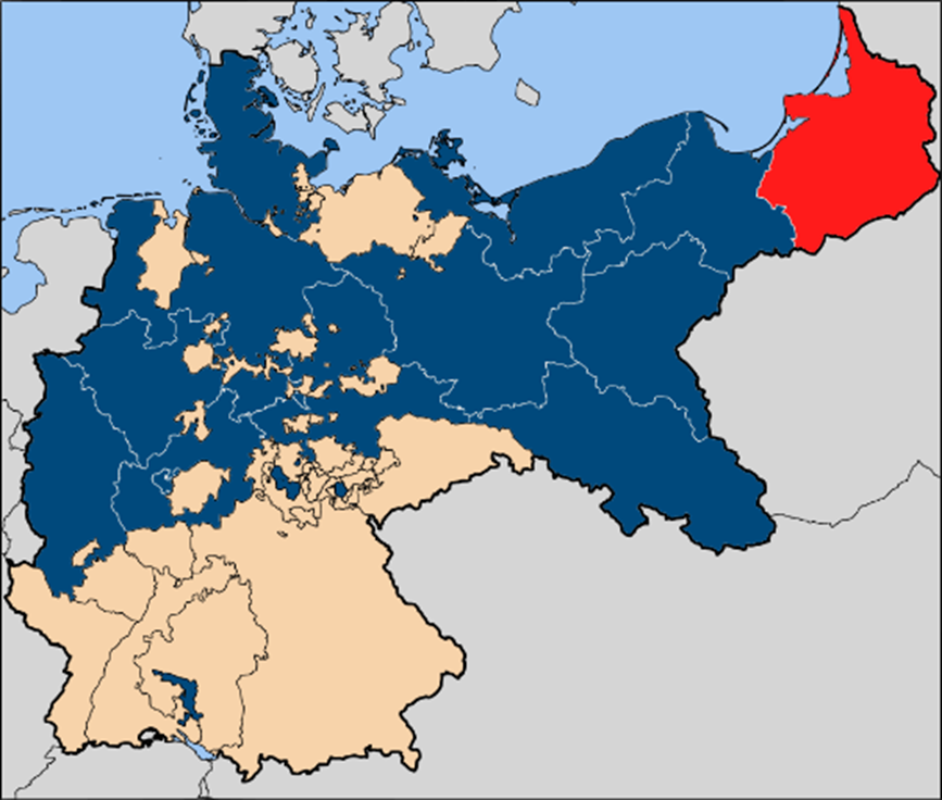
East Prussia as a part of Prussia in the German Empire prior to World War I.2
East Prussia eventually lost its northern part after Germany’s loss in World War I. This was known as Memel. After WWI, the Memel (Klaipėda) region was detached from Germany and put under international administration—then Lithuania took it over in 1923, and the great powers eventually accepted that outcome.
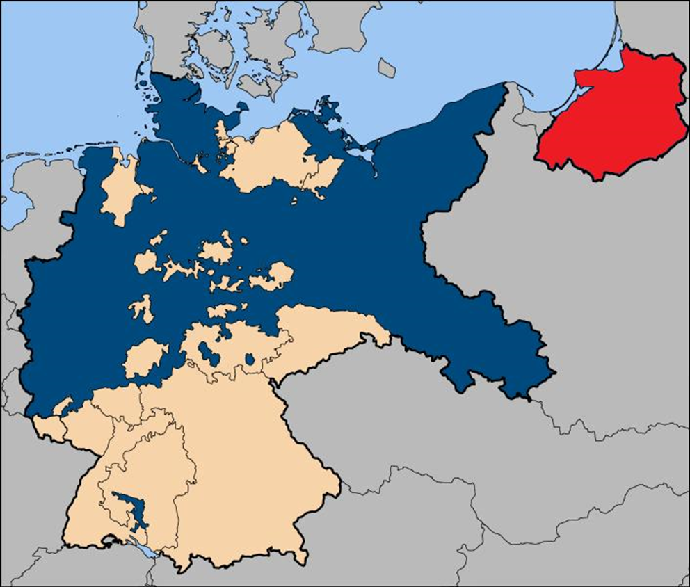
East Prussia as a part of Germany, post World War I.
At Potsdam in 1945, the Allies agreed that northern East Prussia, including Königsberg, would go under Soviet administration—later solidified in the post–Cold War settlement. At this point, in 1945, East Prussia was no more.
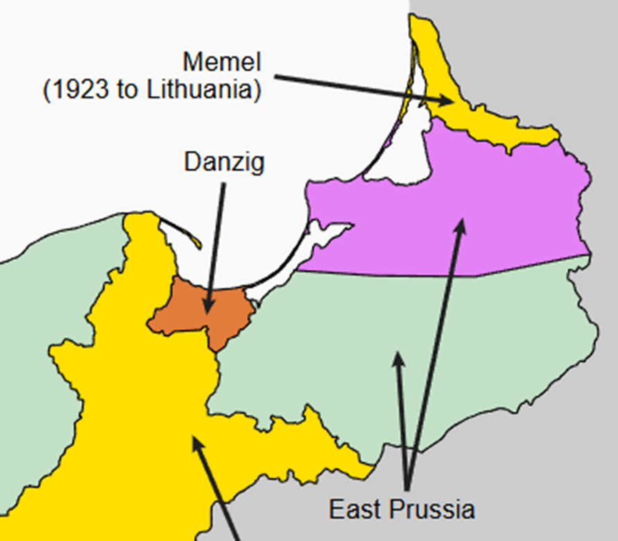
East Prussia, divided. Purple to the USSR, light green to Poland.3
The northern part of East Prussia, which the Soviet Union annexed, was renamed Kaliningrad. It wasn’t granted to Poland or Lithuania, and was a part of the Russian Soviet Federative Republic. It remained as such for the rest of the existence of the USSR.
As for why it wasn’t handed to Lithuania or Poland, the answer is simple: the Soviet Union never intended it to be temporary. Poland was given the southern part of East Prussia, but the northern half was absorbed directly into the Russian Soviet Republic itself.
This wasn’t administrative convenience, but rather a deliberate decision to keep this territory under direct Russian control. Lithuania was a Soviet republic, not an independent state at the time, and the idea of transferring such a strategic region to it never seriously existed.
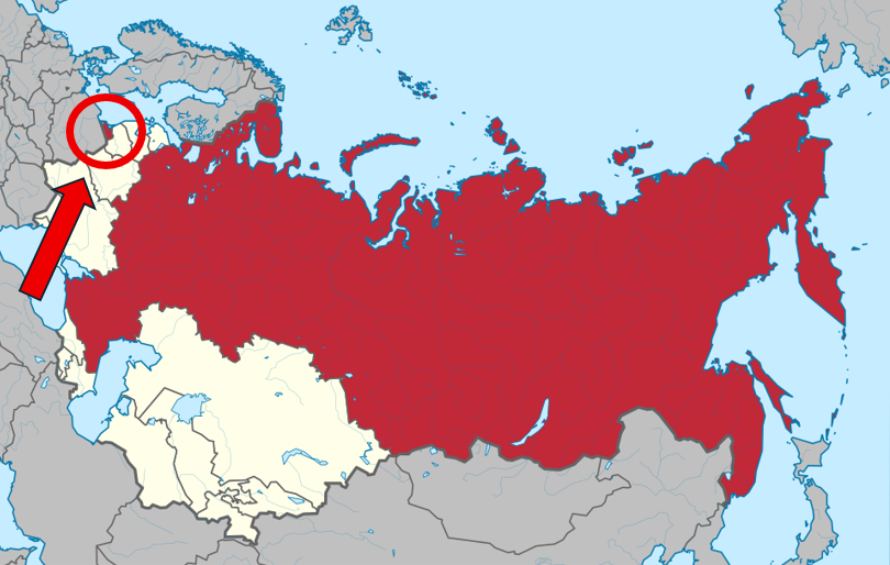
The Russian SFSR before the end of the USSR. That small red speck on the left in Kaliningrad, formerly East Prussia.4
The Soviet Union collapsed in 1991, leaving Kaliningrad suddenly isolated. Lithuania, Belarus, and Latvia were no longer part of the USSR, which meant Kaliningrad no longer had an easy land connection to Russia itself.
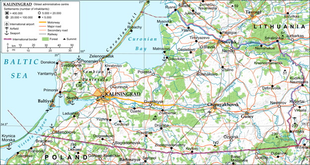
Map of Kaliningrad Oblast in the Russian Federation.5
What’s life even like for those living this Kaliningrad exclave? You might not guess it from the map, but about one million people live on that tiny strip of land. Because any land route crosses EU territory, special facilitated transit documents were created for travel across Lithuania between Kaliningrad and Russia.
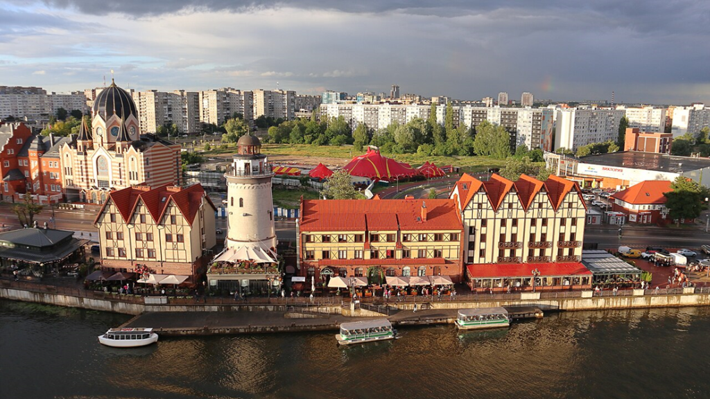
Visitors to Kaliningrad often notice how different its architecture looks compared to the rest of Russia. You’ll see a weird blend—some German-era traces, but also a city heavily reshaped by Soviet rebuilding after 1945.
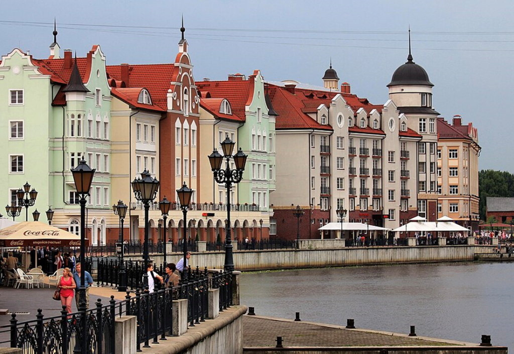
The architecture of Kaliningrad makes it a good tourist destination.6
That’s not to say Kaliningrad is just some forgotten patch of land. To Russia, it’s strategically importantIt’s strategically valuable partly because Baltiysk gives Russia a Baltic port that’s often described as ice-free in winter.
Occasionally, rumors surface that Russia once considered selling the Kaliningrad exclave back to Germany. A story circulates that an ‘offer’ was floated around 1990—but it’s contested and was never an official, serious negotiation. Kaliningrad looks like a question mark on the map, so people assume someone must have tried to erase it.
A fishery village in Kaliningrad Oblast.
But Kaliningrad doesn’t look so dramatic on the ground. There’s no wall, no checkpoint marking where Russia “should” end. It just exists quietly, an ordinary place carrying an extraordinary history.
Since the fall of the USSR, Kaliningrad has remained a part of the Russian Federation. It sits quietly on Europe’s map, a leftover fragment of a vanished empire, and a reminder that borders are often shaped by wars long forgotten. Even today, it continues to catch the eye of anyone who looks closely at a map of Europe.
Image Credits:
1 – Credit: Mschlindwein, CC-BY-SA-3.0. Wikimedia Commons, added red circle and arrow
2- Credit: 52 Pickup, CC BY-SA 2.5, Wikimedia Commons
3- Credit: Aeroid, CC BY-SA 4.0, Wikimedia Commons, image zoomed in
4- Credit: Milenioscuro, CC BY-SA 4.0, Wikimedia Commons
5-Credit: Andrein, CC-BY-SA-3.0, Wikimedia Commons
6-Credit: Aleksander Kaasik, CC-BY-SA-3.0, Wikimedia Commons