
Look at a map of Afghanistan and something looks… wrong.
A thin strip of land stretches east like a long arm, wedged between Tajikistan, Pakistan, and China. It barely seems wide enough to exist. Why is it even there?
That’s a good question. It’s something many people who’ve looked at a map of South Asia have wondered. But the fascinating answer lies in politics and empires that no longer exist.
Meet the Wakhan Corridor
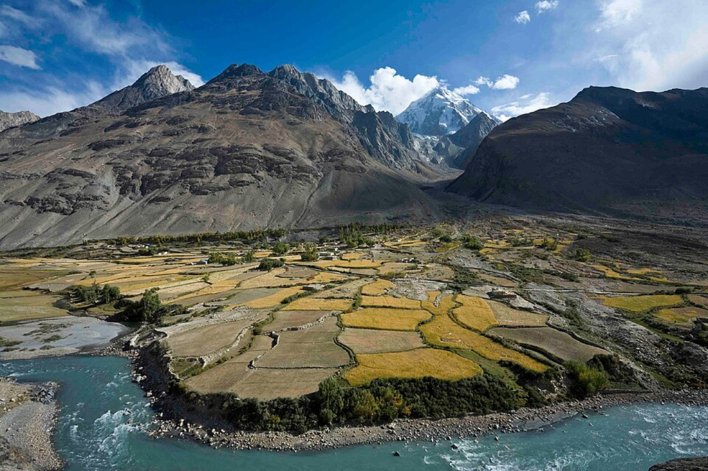
The Wakhan Corridor is mountainous with grassy fields and rivers.
The region is called the Wakhan Corridor. It has mountains, rivers, grassy fields, and is a beautiful strip of land overall. From this narrow strip, Afghanistan borders Tajikistan to the north and China to the east—and it runs along the northern edge of Pakistan-administered territory to the south. However, due to ongoing instability in Afghanistan, foreign travel there generally isn’t recommended. Despite its isolation, an estimated ~18,000 people live in Wakhan today.
Why Does This Even Exist?
You wouldn’t be the first to ask that. In order to find the answer, you have to dig through a bit of history. And that answer is, “The Great Game.” No, not a video game. No, not related to The Most Dangerous Game by Richard Connell. The Great Game is actually a label applied to the power struggle that the British Empire and the Russian Empire had in Central and South Asia in the 19th century for influence in those regions.
Both the British and Russian Empires had strategic interests in these areas. The Russian Empire was expanding through Central Asia. And the British Empire was expanding through South Asia via India. And these two were on a collision course, with neither having much of an appetite for war over this part of Asia.
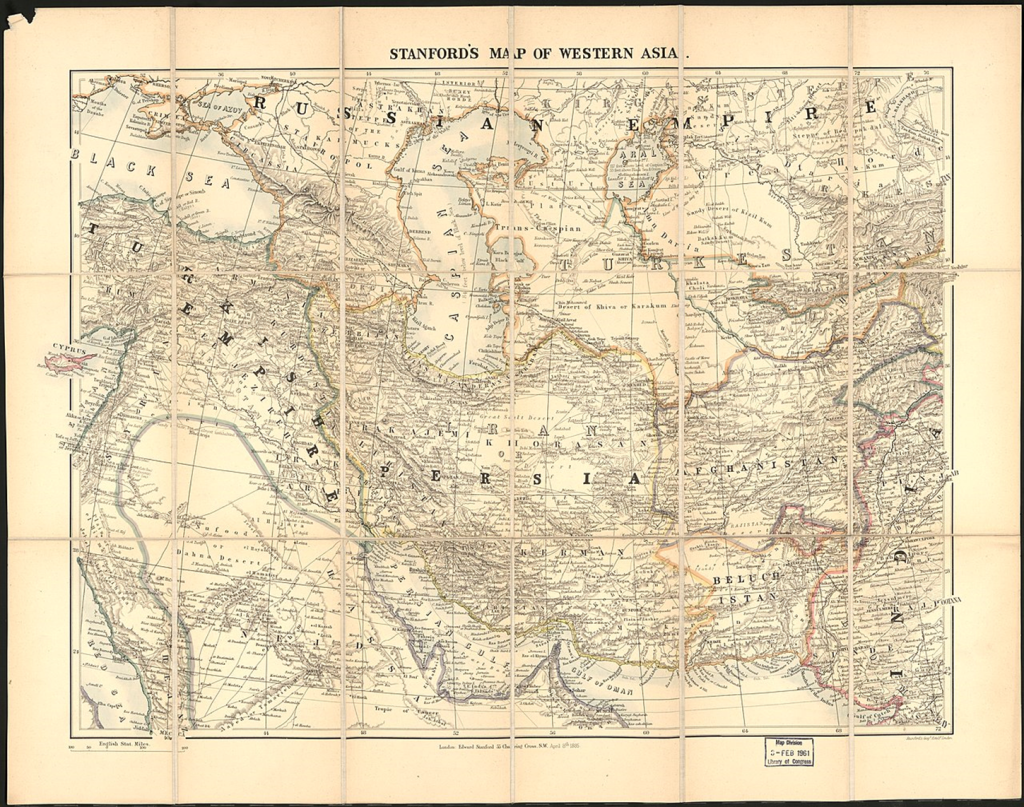
A map of Western Asia in 1885. Afghanistan to the right. British India at the bottom right corner, Russia at the top.
In the late 1800s, British India was expanding north and the Russian Empire was expanding south through Central Asia. To avoid a direct frontier between the two empires, a series of border deals in the 1890s fixed Afghanistan’s boundaries in a way that left a narrow Afghan ‘buffer’ in the far northeast—the Wakhan Corridor. This would reduce the risk of direct conflict between the two Great Powers, and try to stabilize the area between them. Of course, Afghan rulers had limited leverage compared with the empires negotiating around them.
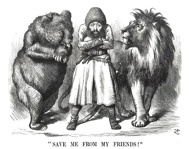
Political cartoon depicting the Afghan Emir Sher Ali with his “friends” the Russian Bear and British Lion (1878)
It is still here today because borders, once drawn, are surprisingly hard to erase. Even though the British and Russian Empires no longer exist, the modern countries that replaced them inherited their borders. Changing borders means opening old disputes, risking instability, and potentially starting conflicts no one wants.
What It All Means
The Wakhan Corridor is a narrow strip of Afghan territory in the far northeast of the country. Afghanistan, China, Pakistan, and Tajikistan all recognize the Wakhan Corridor as part of Afghanistan, and none of them have much to gain by challenging it. The strip is remote, sparsely populated, and extremely difficult to access. It’s remote, sparsely populated, and extremely difficult to access—so large-scale development has historically been limited. So it remains exactly where 19th-century diplomats left it.
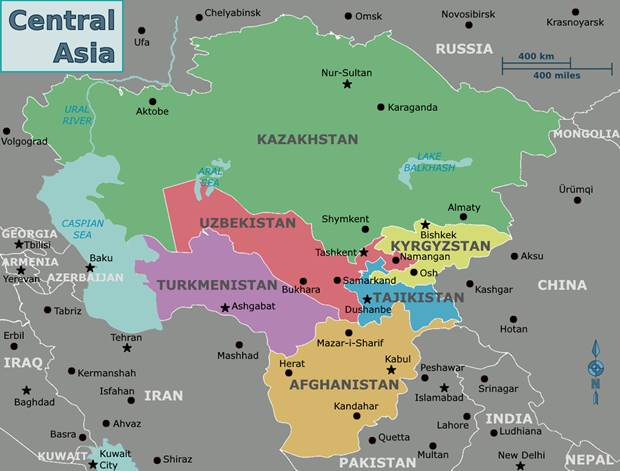
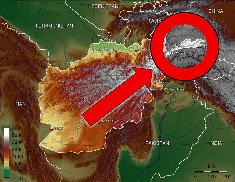
A map of Central Asia, the Wakhan Corridor seen in northeastern Afghanistan.
The Wakhan Corridor still matters today because it quietly connects four major regions of Asia. It gives Afghanistan its only direct border with China. It separates Pakistan from Tajikistan. And it sits along routes that once linked the Middle East, South Asia, and Central Asia through trade.
It also remains strategically sensitive. China keeps a close eye on it because of concerns about regional security and stability near Xinjiang. Pakistan views it as a buffer near its northern frontier. And Afghanistan sees it as one of the few areas that has remained relatively isolated from decades of conflict.
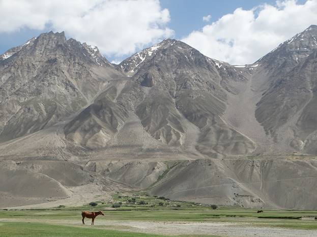
The mountains of the Wakhan Corridor.
In a strange way, the Wakhan Corridor is still doing what it was designed to do: acting as a buffer zone. Only now, instead of separating the British and Russian Empires, it sits quietly between modern states with very different political systems and interests.
Hero image credit: Thuresson, CC-BY-SA-3.0, Wikimedia Commons. Added circle and arrow, cropped.
Map of Central Asia Credit: Cacahuate, CC-BY-SA-4.0, Wikimedia Commons.